
Soil Properties to Measure
Document more than just basic elements in the soil with the updated Additional Measured Soil Properties table.

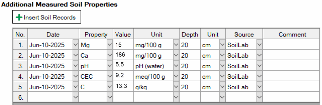
- Generalized to document properties and elements of the soil, e.g. temperature, moisture, water holding capacity.
- Useful for trial-wide soil analyses, even if they occur multiple times during the season. If taking a soil sample for each plot, an Assessment column is still the best way to record this data!
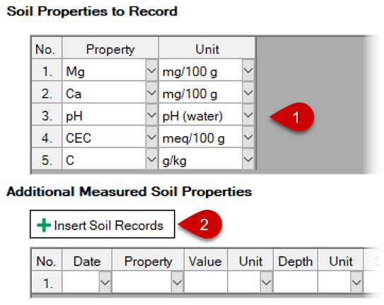
Workflow to record soil properties, especially for repeated analyses:
- Select properties and units to record (can be specified in Protocol).
- For a given analysis data, select Insert Soil Records button.
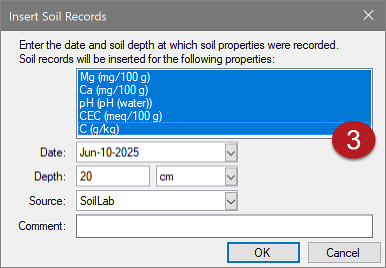
- Confirm properties to record and enter other details about the sample.
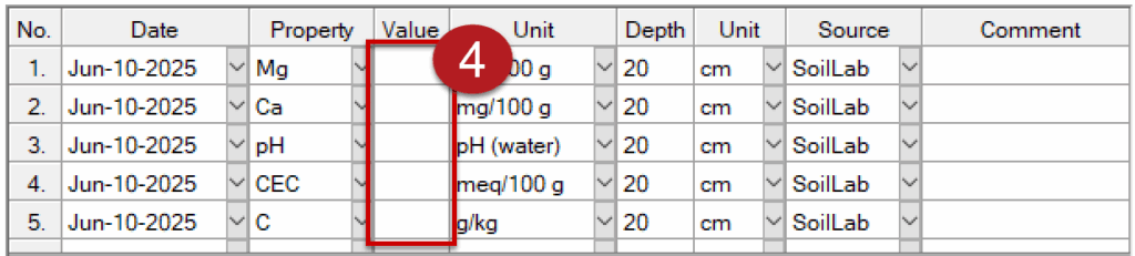
- Click OK to insert and auto-fill rows for selected properties to record.


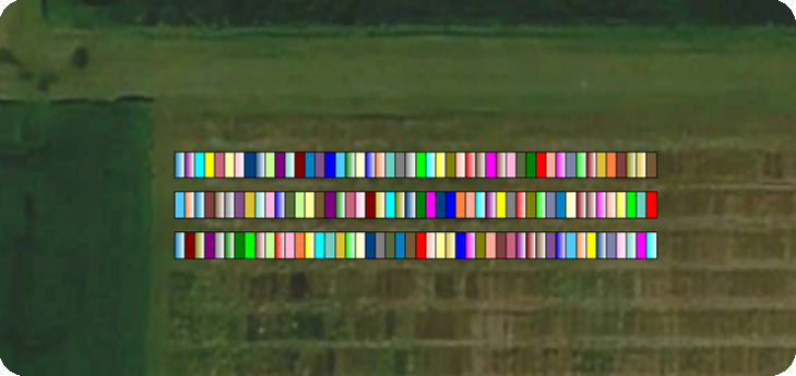
Beta Version of Geospatial Trial Map
Bring your trial locations to life with the ARM Geospatial Trial Map!
- Create the map with menu command Window > Geospatial Trial Map (Beta).
- Trials are georeferenced: all plots are assigned to GPS coordinates, to be used with GIS systems.
- Overlay trial onto satellite map or drone imagery.

Frequently Asked Questions
Is the original ARM Trial Map still available?
Yes, the original ARM Trial Map will remain available to users for the foreseeable future.
Is this the final product?
No, we are still developing the map so features and functionality may still change.
How do I submit feedback for the Geospatial Trial Map?
Email support@gdmdata.com with any feedback for the new Geospatial Trial Map!
Are tutorial videos available for the Geospatial Trial Map?
Yes! See Geospatial Map Basics.